Big Bend Bouldering
Nature’s perfect playground! We stopped to grab a “quick” picture of the view on this bend of the Colorado River. We had passed it many times but the light here was just too perfect with the Red Cliffs of Moab kissed by the sun behind. What we discovered is the perfect place for my three boys climb and explore! There are lots of technical bouldering climbs that are well marked with chalk we skipped those and just climbed up and around the giant boulders that spilled long ago from the cliffs above. It was a great short pit-stop, but next time I think we we might plan a lot more time here. It was relatively peaceful and only one other car was there on this crisp January day in 2022! Definitely recommend making this stop if have adventurous kids that are a little tired of playing on metal playgrounds! No padding here, unless you bring it yourself.
Adventure Details
- Highlights: Views of the Colorado, Climbing & Bouldering
- No Hiking Required
- Non-plumbing Bathrooms at Campground
- Easy & Difficult Climbs
- No Fees | Free to Park
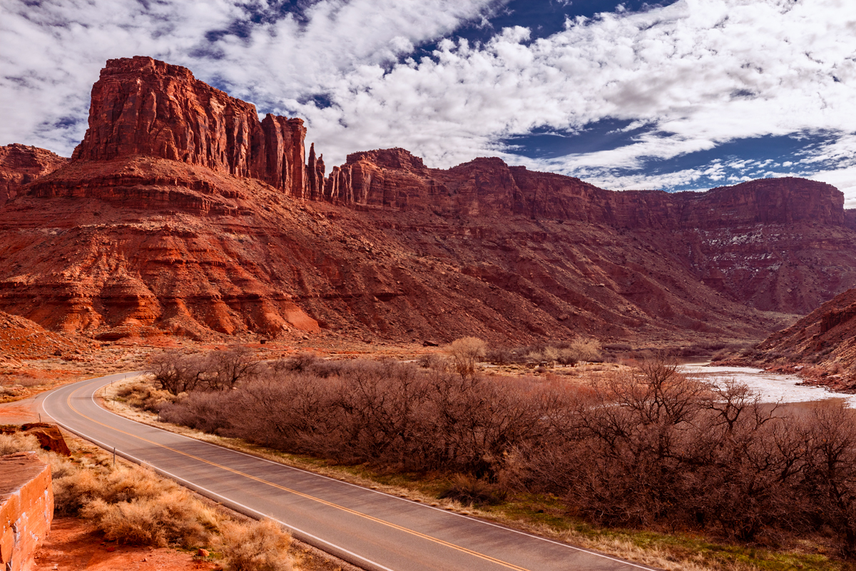
Big Bend with Colorado River
You can see the entrance to the parking lot at the left edge of this image, to get this view I climbed a boulder or two. I also grabbed a shot from across the street a little inside the trees, but much preferred the higher vantage point this angle provided.
Shot Details
EF 16-35mm f/2.8L III USM
1/320 sec at f / 10 ISO 250
29mm focal length
Jan 18, 2022 at 11:56 AM
38°39’0.672″ N
109°29’4.176″ W
4,062.3 ft Altitude
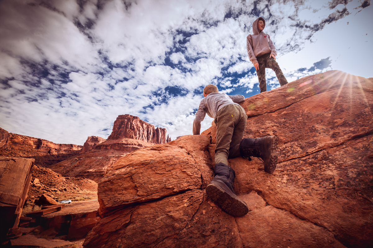
King of the Boulder at Big Bend
Even in his winter boots our youngest son was able to keep up with his two older brothers as they ran from boulder to boulder, finding their own way to the top as they went. Keen eyes will spot our lone car in the parking lot
Shot Details
EF 16-35mm f/2.8L III USM
1/125 sec at f / 10 ISO 250
16mm focal length
Jan 18, 2022 at 11:55 AM
38°39’0.672″ N
109°29’4.176″ W
4,062.3 ft Altitude
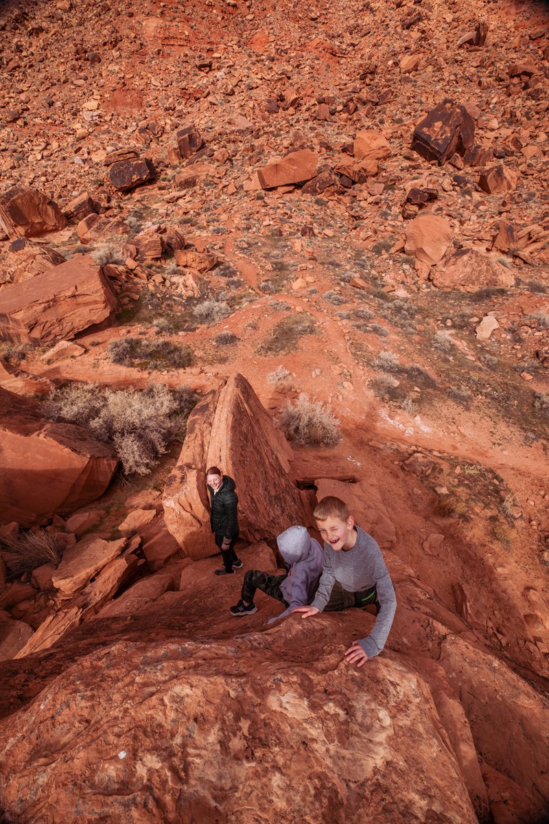
Looking Down
The bright afternoon sun was a bit harsh looking up but looking down was all in the shade! The wide angle lens helps dramatize the view from the top, but then again, in real-life this was one of the steeper (and scarier) climbs down especially holding a camera. Luckily I was able to hand it off to Jenny and do a successful scoot down after this shot.
Shot Details
EF 16-35mm f/2.8L III USM
1/160 sec at f / 10 ISO 250
16mm focal length
Jan 18, 2022 at 11:56 AM
38°38’59.982″ N
109°29’5.124″ W
3,852.0 ft Altitude
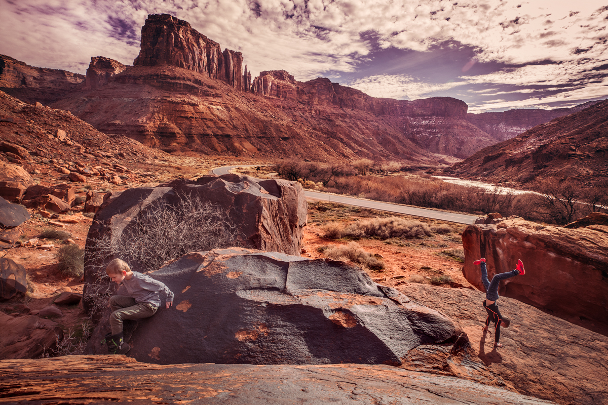
Hand Stand on Red Cliffs
My middle son was a champ, doing the handstand several times in a row to get the right shot. The scenery feels magic, and seeing these cliffs star in so many movies you do get the sense you’re on a bigger than life adventure here. *This shot was Mom supervised and no children were harmed during the adventure.
Shot Details
EF 16-35mm f/2.8L III USM
1/200 sec at f / 10 ISO 250
16mm focal length
Jan 18, 2021 at 11:47 AM
38°39’2.73″ N
109°29’4.848″ W
3,917.0 Altitude
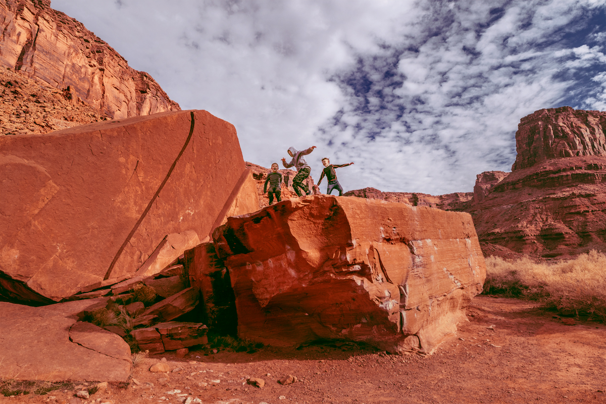
Kids Jumping on Boulders
All three of my boys striking their best aerial pose, an appropriately safe distance from the edge.
Shot Details
EF 16-35mm f/2.8L III USM
1/250 sec at f / 10 ISO 250
20mm focal length
Jan 18, 2022 at 11:52 AM
38°39’0.372″ N
109°29’4.398″ W
4,027.2 ft Altitude
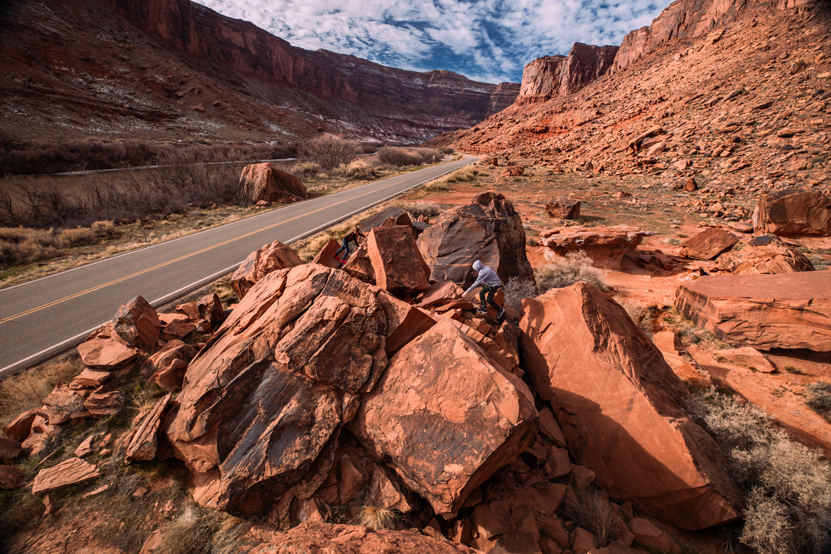
Boys, Boulders & River Road
We kept going further East finding new boulders to climb. You can spot two of my boys while my youngest is exploring the cracks just below his older brothers. Exploration was top on their list, which was so fun to try and keep up with. As you can see from the vantage point I was still on the top of the last boulder when I cuaght this shot.
Getting This Shot!
EF 16-35mm f/2.8L III USM
1/160 sec at f / 10 ISO 250
20mm focal length
Jan 18, 2022 at 11:57 AM
38°38’59.982″ N
109°29’5.124″ W
3,852.0 ft Altitude


