Devils Garden & Landscape Arch
8 Named Arches Including: Landscape Arch, Pine Arch, & Tunnel Arch
One of the world’s longest stone spans is just a short (1.9 mile/3.1 km roundtrip) hike from Devils Garden Trailhead to Landscape Arch. The hike easy, mostly level with only moderate hills up and down and virtually no elevation gain. There is a longer Primitive trail hike beyond Landscape Arch for the more advanced explorers that leads to Double O arch.
The trail is a great one, with short side trails to see other arches Like Pine Arch and Tunnel Arch. Open year round, an afternoon will give you the best chance of capturing the sun through the Landscape Arch. Up until 1991 you could hike a lot closer to the arch.
The recent partial collapse was caught on video, thankfully nobody was injured,
Adventure Details
- Highlights: Multiple Named Arches including longest span in our hemisphere.
- Easy 2 mile hike, steepest part is the beginning
- Non Plumbed Bathrooms
- Arches National Park Fee & Reservation Required
MAP LEGEND: Dark Red is part of the featured adventure. Light Gray are additional nearby highlights.
Which Trail To Take?
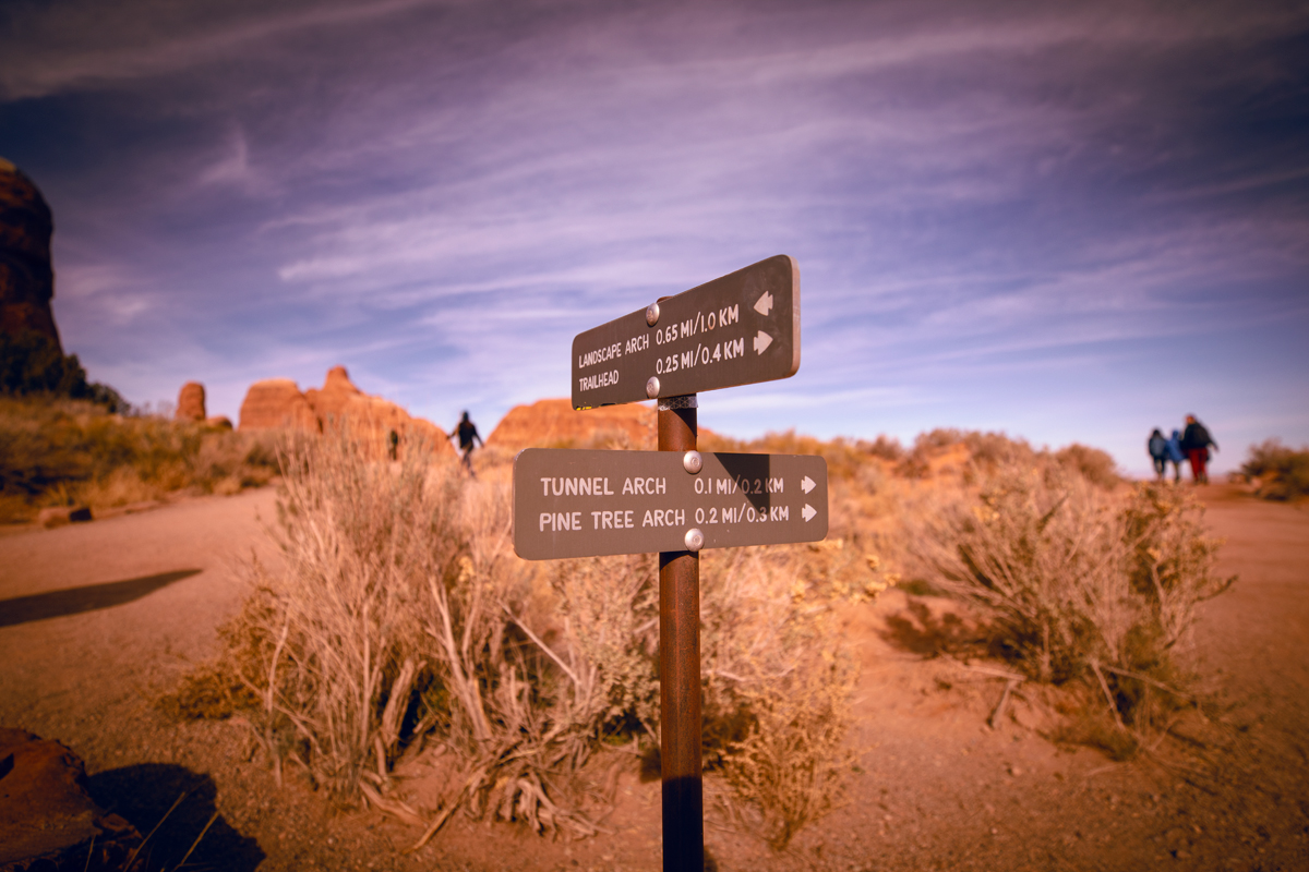
Just through the cliffs that will make you feel like you’re in an Indiana Jones movie you’ll come to this fork in the road, we took the right trail first but looped back to hit Landscape Arch as well.
Shot Details
EF 16-35mm f/2.8L III USM
1/2000 sec at f / 2.8 ISO 100
16mm focal length
November 18, 2021 at 1:13 PM
38°47’5.988″ N 109°35’51.684″ W
5,106.3 ft Altitude
Tunnel Arch
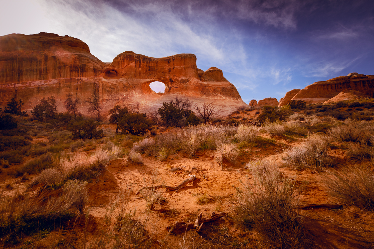
Not far from the parking loop at Devils Garden you don’t want to miss this side trail, from the top you can’t see what you are missing but once you go down the short trail into the ravine you’ll see this large and beautiful opening in the red cliffs you just hiked under.
Shot Details
EF 16-35mm f/2.8L III USM
1/1600 sec at f / 2.8 ISO 100
16mm focal length
November 18, 2021 at 1:17 PM
38°47’7.824″ N 109°35’47.058″ W
5,191.6 ft Altitude
Pine Arch
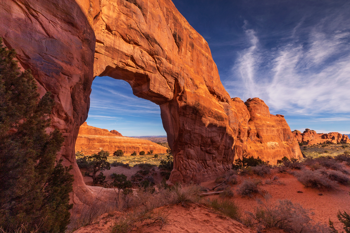
Am I the only one that sees the rough shape of the state of Utah in this jagged opening of the Pine Arch? Did the state planners put the wrong arch on the Utah State License Plates? Don’t miss this short hike down to see this spectacular arch, afternoon sun seems to catch it best.
Getting This Shot!
EF 16-35mm f/2.8L III USM
1/250 sec at f / 13 ISO 100
16mm focal length
November 18, 2021 at 1:37 PM
38°47’14.926″ N
109°35’56.0071″ W
5,209.3 ft Altitude
Landscape Arch
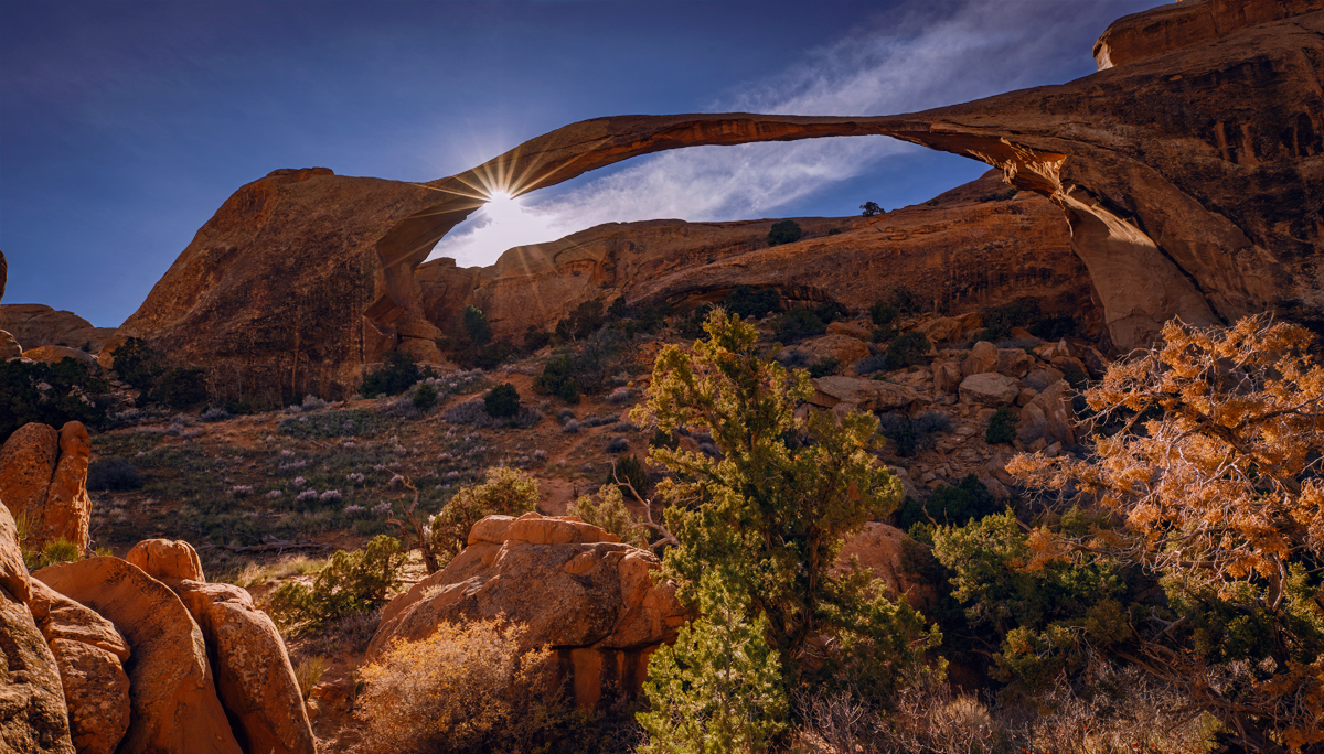
Staying on the designated trails is a strict rule for your safety, as well as the safety of the desert ecosystem. At this particular spot on the marked trail the foreground is perfect and with a wide angle lens you can capture the entire breathtaking span! This is about 0.8 miles (1.2 km) from the parking and is just 6 meters wide at the thinnest point.
Shot Details
EF 16-35mm f/2.8L III USM
1/640 sec at f / 10 ISO 400
20mm focal length
November 18, 2021 at 2:19 PM
38°47’28.092″ N
109°36’24.114″ W
5,216.9 ft Altitude
Beautiful Trails
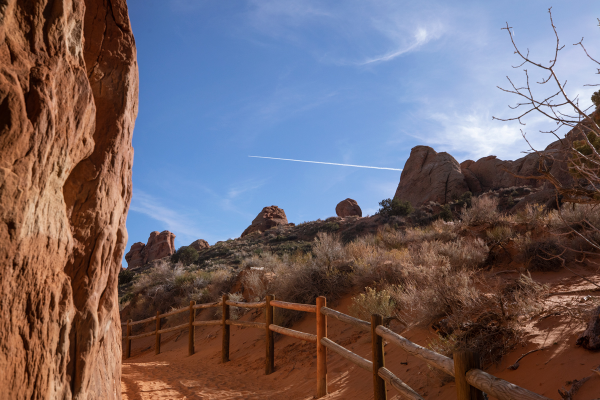
The well maintained trails offer plenty of spectacular scenes of their own and nearby Landscape Arch there are plenty of hidden treasures to spot along the side-trails. This area was one of my kids favorite spots to explore!
Shot Details
EF 16-35mm f/2.8L III USM
1/1250 sec at f / 10 ISO 400
135mm focal length
November 18, 2021 at 2:42 PM
38°47’28.152″ N
109°36’22.254″ W
5,186.4 ft ft Altitude
Primitive Trail
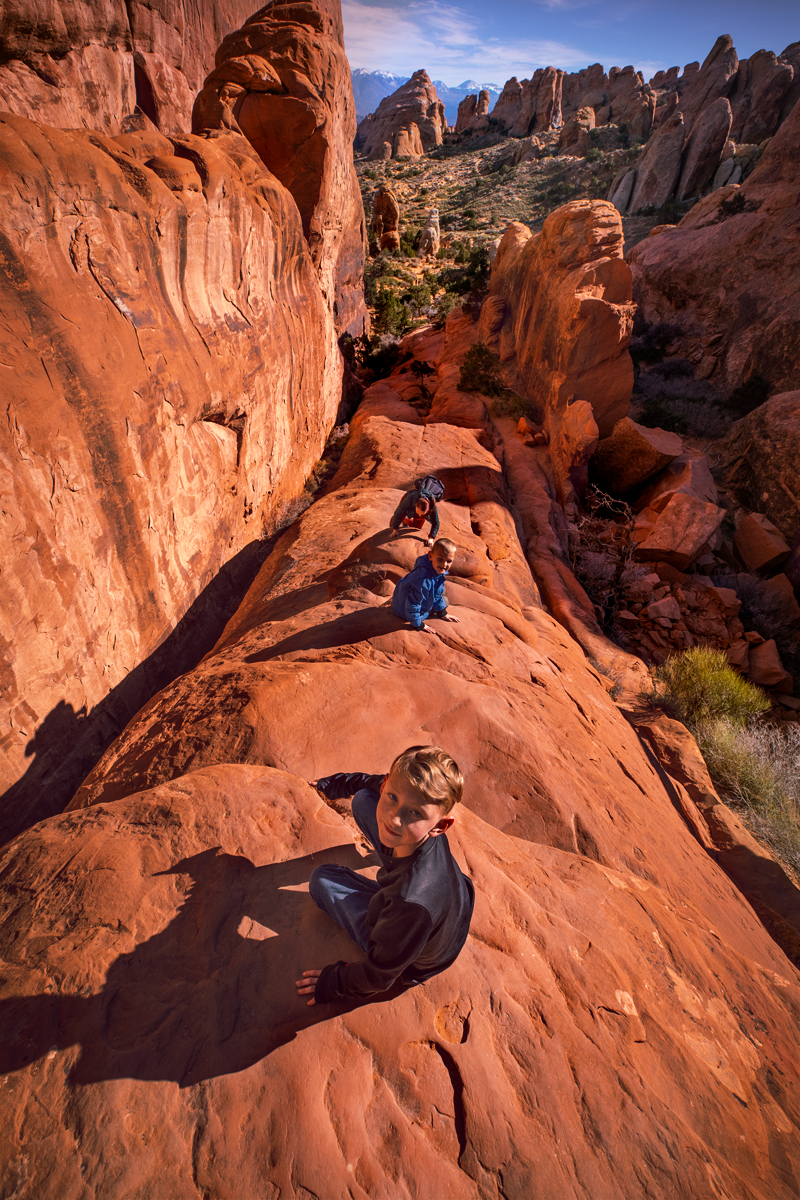
If you look closely on the inset map you’ll see the primitive trail continues past the Landscape Arch up this adventuresome rock face, a perfect spot to turn around and grab a shot of your group!
Shot Details
EF 16-35mm f/2.8L III USM
1/800 sec at f / 10 ISO 400
16mm focal length
November 18, 2021 at 2:29 PM
38°47’32.904″ N
109°36’28.176″ W
5,339.2 ft Altitude


