Jug Handle Arch
Drivers will spot a sign clearly marking the Jug Handle Arch turn-off about 15 miles West from Moab on UT-279 (Potash Road).
Just off the dirt road you’ll find the parking turn-off and can see the arch from your car if you look back the way you came. A short trail up has some steep and slippery parts but the hardest part of the trail might be finding it as it is somewhat hidden.
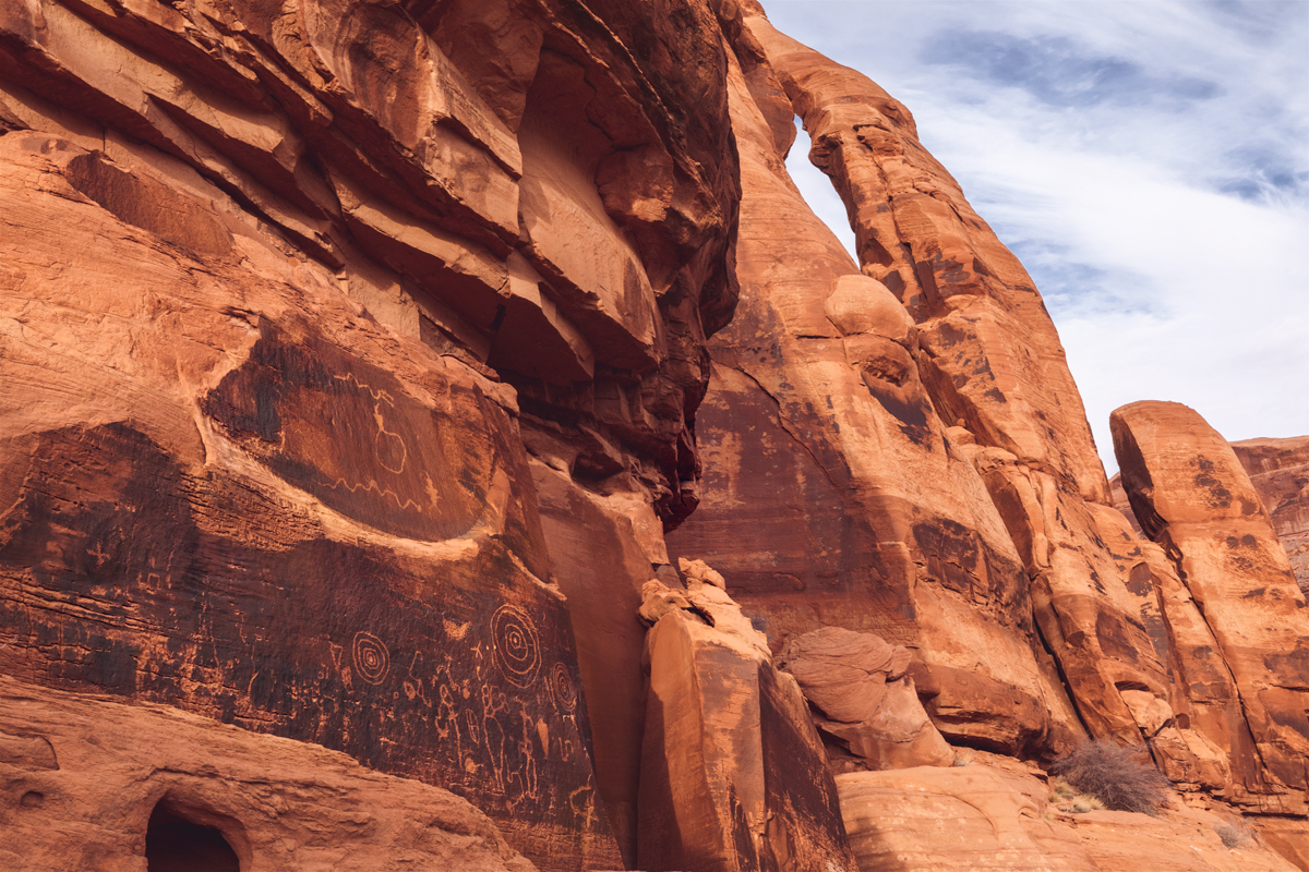
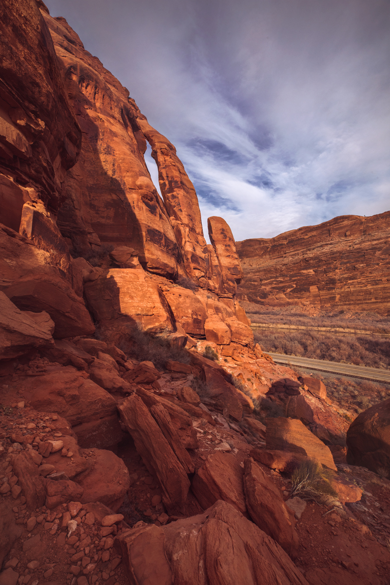
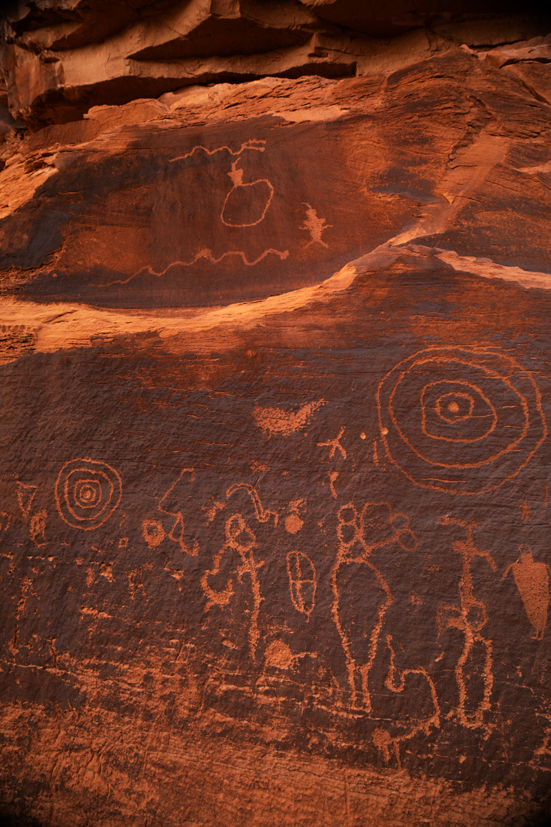
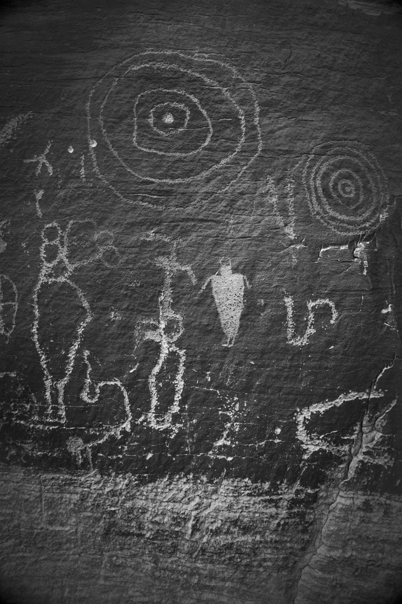
Right underneath the arch you can get a spectacular up close look at some of the earliest Petroglyphs in Moab, and a view of the parking lot as well, which is more scenic than you’d think!
Rock climbers refer to this area as Wall Street South, so a number of technical rock climbs and rappels down Jug Handle Arch are well documented.
The dirt road into Long Canyon eventually leads to Dead Horse Point and Canyonlands National Park; following Potash Road further West brings you past the Potash Boat ramp and turns into a publicly accessible private dirt road which eventually leads to Thelma & Louise Point and Shafer Trail.
Adventure Details
- Highlights: Arch, Petroglyphs
- Less than 1 hour
- No Bathrooms
- Hard to spot trail, steep in parts
- No Fees | Free to Park
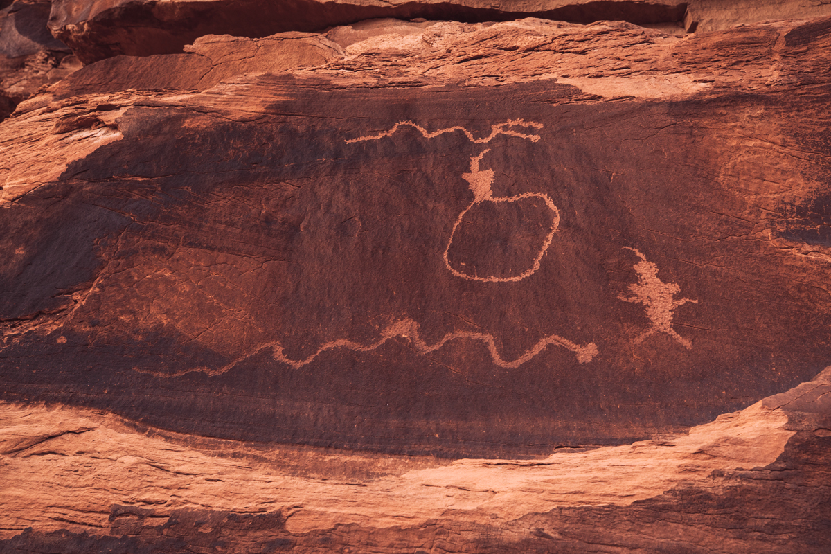
Jug Handle Arch with Petroglyph
When you climb your way to the top you are rewarded not just with a closer view of the arch but these amazing petroglyphs up close.
Shot Details
EF 16-35mm f/2.8L III USM
1/80 sec at f / 16 ISO 1000
35mm focal length
Jan 18, 2022 at 4:44 PM
38°32’52.902″ N
109°38’55.074″ W
3,885.2 ft Altitude
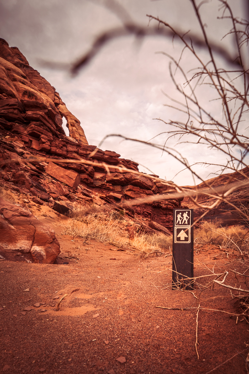
Trail Marker & Jug Handle Arch
Heading towards the arch from the parking lot you will cross a washout, turn to the right and you will find this short trail marker in the sandy wash nearly over-run with nature. Lucky it was there, because as you see the less-travelled trail is a little hard to spot.
Shot Details
EF 16-35mm f/2.8L III USM
1/250 sec at f / 8.0 ISO 640
16mm focal length
January 18, 2022 at 5:01 PM
38°32’52.65″ N
109°38’54.876″ W
3,938.0 ft Altitude
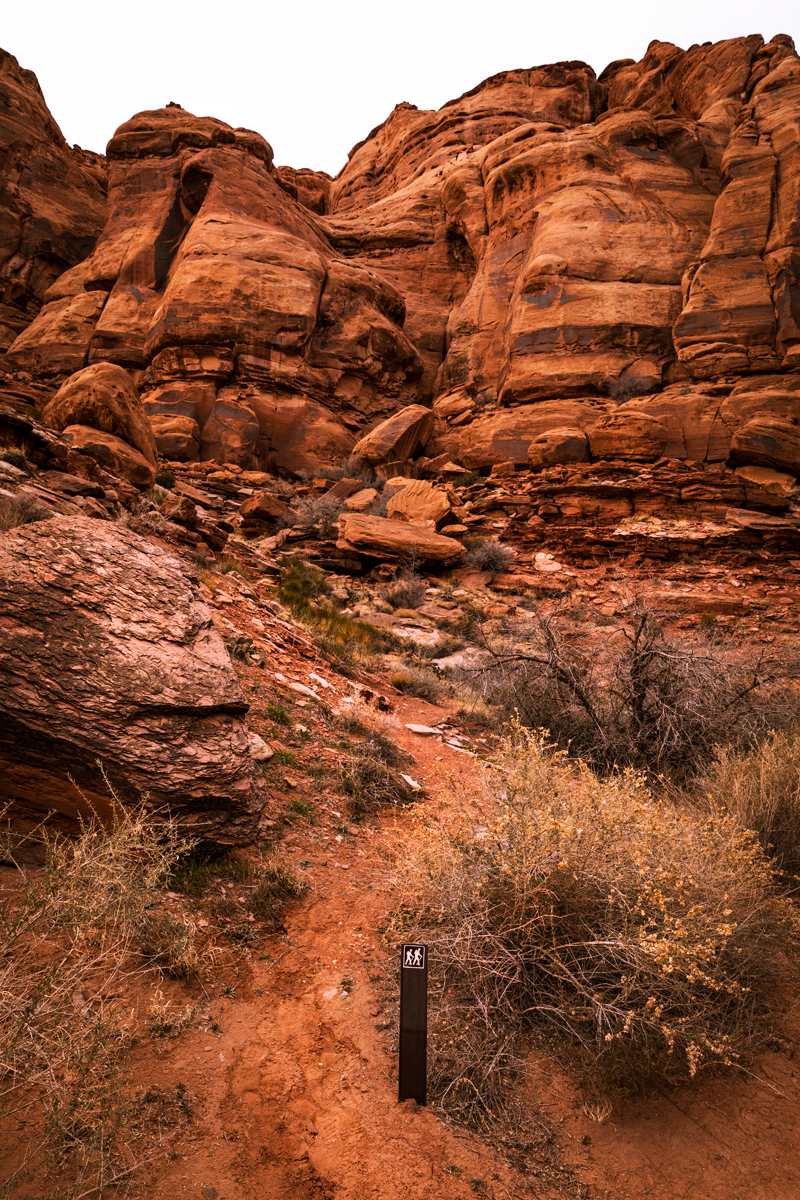
Trailhead UP to the Petroglyphs
I felt off trail a couple of times looking for this trail marker, don’t give up if you follow a wrong trail for a spell because there are a few false leads.
Shot Details
EF 16-35mm f/2.8L III USM
1/250 sec at f / 8.0 ISO 640
20mm focal length
January 18, 2022 at 4:59 PM
38°32’52.302″ N
109°38’54.336″ W
3,947.2 ft Altitude
Rocky Angle of Jug Handle Arch
On the way up you’ll find great views of the arch that looks a bit more delicate the closer you get.
Shot Details
EF 16-35mm f/2.8L III USM
1/100 sec at f / 16 ISO 400
29mm focal length
Jan 18, 2022 at 4:42 PM
38°32’52.902″ N
109°38’55.074″ W
3,885.2 ft Altitude
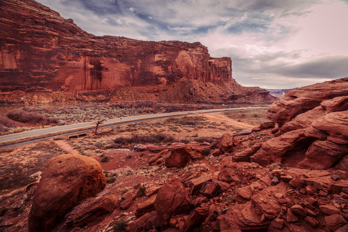
View of Potash Road
At the top of the hike you can see the parking lot and a great view of Potash Road.
Shot Details
EF 16-35mm f/2.8L III USM
1/160 sec at f / 10 ISO 640
16mm focal length
January 18, 2022 at 4:52 PM
38°32’52.65″ N
109°38’54.876″ W
3,938.0 ft Altitude
Petroglyphs below Jug Handle Arch
These are some of the earliest examples of Petroglyphs in the area, from about 2,000 BC.
Shot Details
EF 16-35mm f/2.8L III USM
1/200 sec at f / 5.6 ISO 640
16mm focal length
January 18, 2022 at 4:50 PM
38°32’52.758″ N
109°38’54.75″ W
3,914.0 ft Altitude
Shot Details
EF 16-35mm f/2.8L III USM
1/125 sec at f / 7.1 ISO 640
35 mm focal length
January 18, 2022 at 4:54 PM
38°32’52.65″ N
109°38’54.876″ W
3,938.0 ft Altitude
Shot Details
EF 16-35mm f/2.8L III USM
1/125 sec at f / 7.1 ISO 640
16 mm focal length
January 18, 2022 at 4:53 PM
38°32’52.65″ N
109°38’54.876″ W
3,938.0 ft Altitude

